 |
The boat trip in April 2008 |
|
Log book Ireland April 2008
|
|
back to the
main page |
|
|
|
|

|
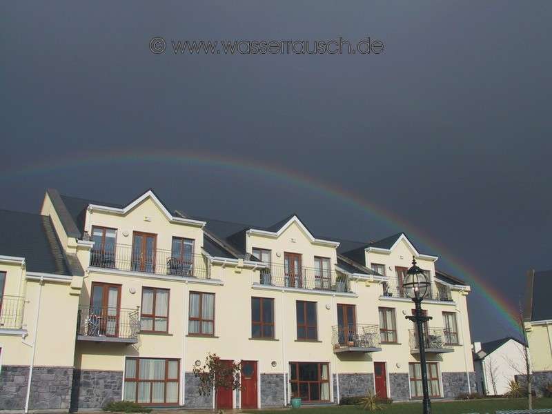
Wedbesday 09.04.2008 Kiltybardan - Keshcarrigan - Leitrim Length of boat trip: 4.5 hours Motto of the day: 16 locks without turning, kingfishers again, rainbows, female crew from the Bavarian Free State, pontoon in the navigation, dinner in Leitrim
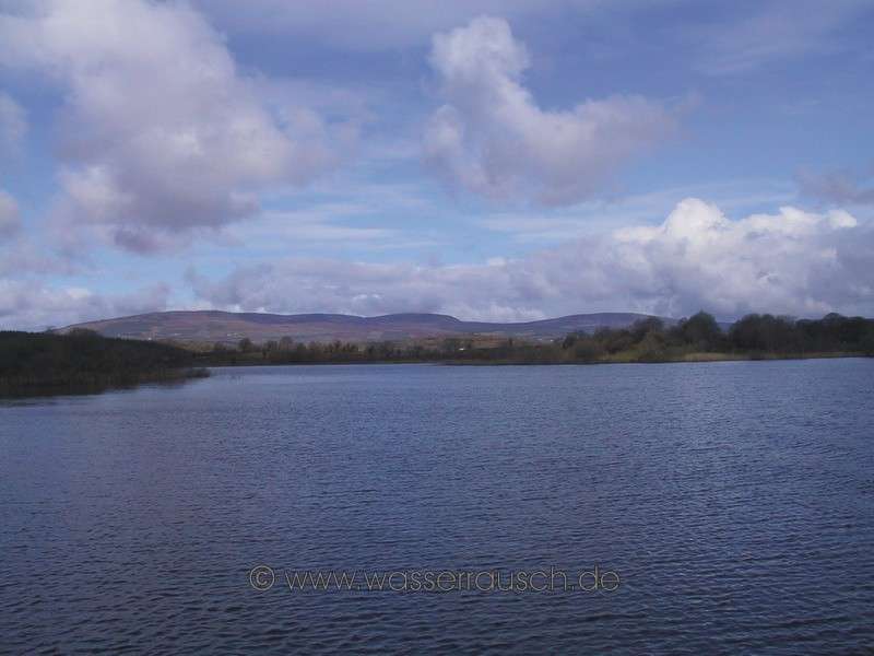
This night was cool, but the day will be as mild as yesterday. Sun and clouds alternate in the morning. The water is like a mirror til a shower dapples the lake with rings. Swallows hunt, flying low over the water. We drive back to St. Johns Lough and further west. After a further two shallow and very small lakes, Lough Muckros and Lough Marrave, the navigation leads to the small village of Keshcarrigan; Ceis Charrigan, wicker causeway of the little rock. Standing proudly, with its flattened summit, on the northern shore, Slieve Anierin; Sliabh an Iarainn; (Map 3 ), a mountain formed primarily of sandstone embedded with ferrous strata, imposing cliffs and nearly symmetrical stands of coniferous forests on its southern and eastern flanks. There are also remains of older forests with 500-year-old oak trees located in the southeast, Aughacashel.
The route now goes 1.5 km WSW of Keshcarrigan lieing Sheebeg Hill (Map 4 ), on which there is a Cairn (stone grave). In the 1930s, the Cairn was opened and inside the tomb passage the skeletons of a man and a woman were found. Local legends say that it is the burial place of Finn McCool; Fionn MacCumhaill, the legendary leader of the Fianna. In the 18th Century, a local landowner built a statue of Fionn MacCumhaill on the cairn. This was twice destroyed by storm, which the locals see as the work of fairies and elves, which felt disturbed by that. A modern statue of Fionn is now located at the village entrance of Keshcarrigan. West of the Slieve Anierin, though not visible to us, is Lough Allen. On its western shore rise the Arigna Mountains with Kilronan and Corrie Mountain (Slentannasaggart) (426 m). Between the two ridges is the valley of the Arigna River. From Keshcarrigan these mountains with their wind turbines can be seen in a north-westerly direction.
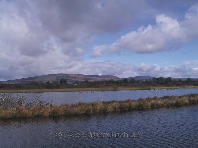
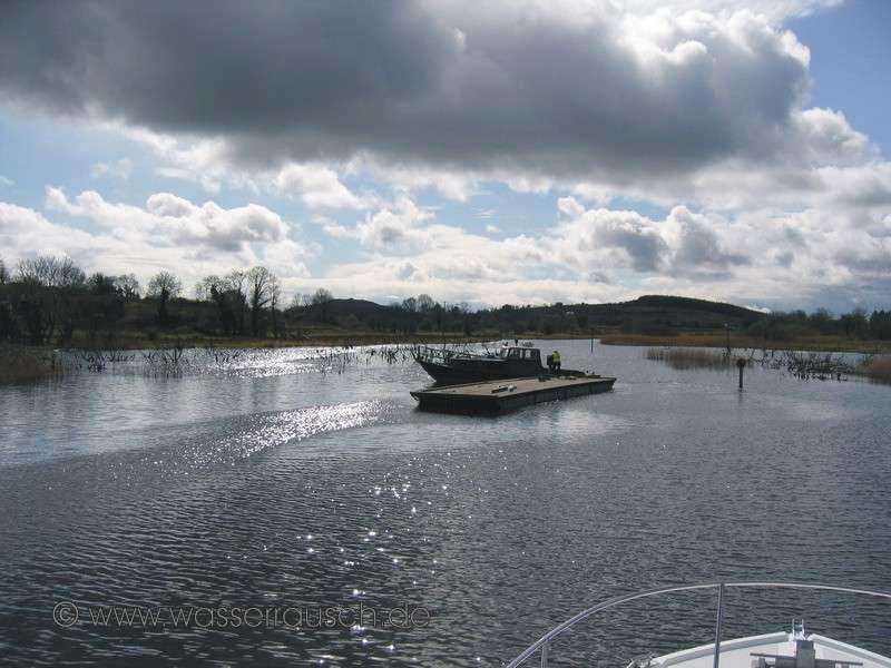
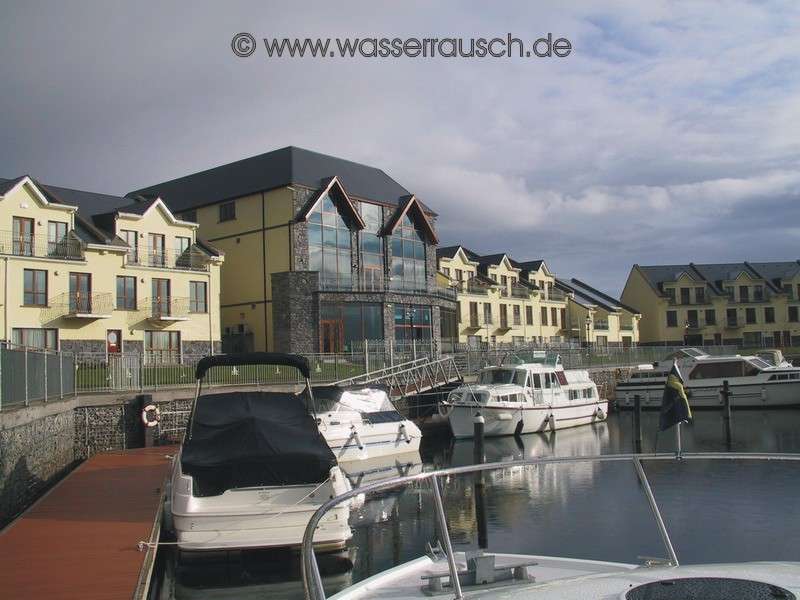
In the shallow Drumleague Lough, a pontoon of WI is blocking our way. We wait and hold the boat on the spot, until the working boat has moved its platform away. After we have passed, the staff of Waterways Ireland continue to repair a marker. Now the route goes through a canalised section, through eight locks down to the Shannon and the village Leitrim, passing, on the southern bank, a hill called Sheemore (Map 4 ) with three unopened Cairns on top. On the largest of them, a cross, which is lit at night, has been erected. A view of Sheemore and two small showers with large rainbows accompany us during our lock-through. In Kilclare, we meet the first and only occupied boat this day, with a female crew of two and a giant Bavarian free state flag and an unusual technique of clamping ropes in the locks and an even more unusual technique of bankmooring at the canal bank whilst driving. At Leitrim we arrive for the first time in the Shannon without needing to turn a single one of the 16 locks! We moor in the small private port of Leitrim Marina Hotel and relax in the restaurant with a delicious dinner.
Thursday 10.04.2008 Leitrim - Carrick-on-Shannon - Jamestown Canal - Carnadoe Quay Length of boat trip: 3.7 hours Motto of the day: Replacement of a fuse, Doon of Drumsna, Gerda and Slieve Anierin with snow After a cool night the day starts sunny, but the clouds promise
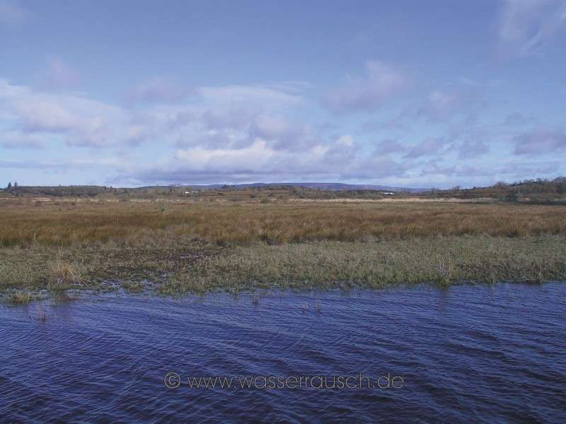
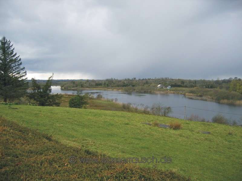
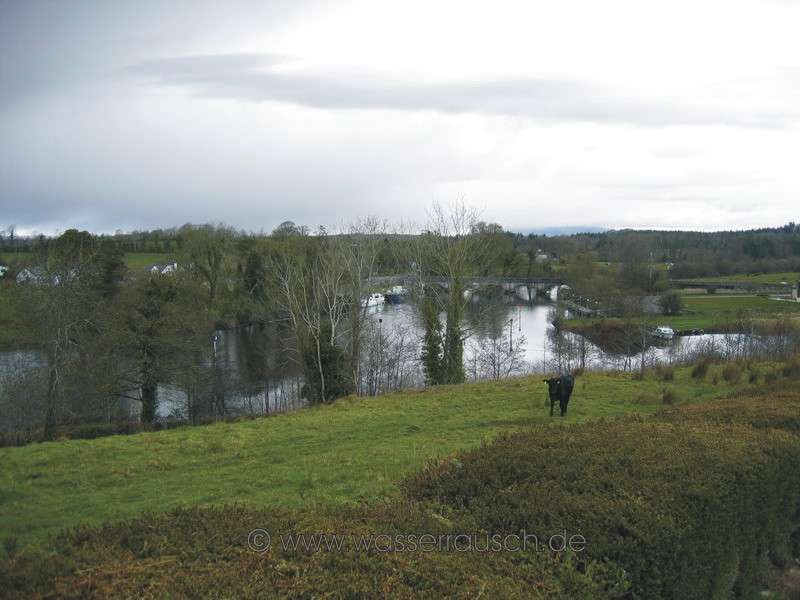
Starting in Leitrim, south of Slieve Anierin, Lough Allen and the Arigna Mountains (In the right photo in the background) we reach the Shannon Corridor. This landscape in the northern section of the Shannon River has wide flooding areas and also drumlins, which extend in a belt from the Ballinamore Lowlands. Grasslands with bulrushes and wetlands line the river to Carrick-on-Shannon. Only a few buildings are close to the river. The people in olden times preferred to build safe settlements further away from the river on hills. This old knowledge seems to be lost to the initiators and participants of some recent, fairly daring real estate projects in the floodplains. A number of drainage ditches cross the flat pasture land and the Shannon winds in large bends through this unique landscape of floodplains, where trees are sparse. More than 220 km of the Shannon between the mouth of the headstream in Lough Allen and Limerick are navigable. The surface source of the Shannon, whose waters are collected in the underground limestone of the Cuilcagh, is 152 m above sea level. Between Leitrim and Killaloe (Lough Derg) there is only about a 12 m drop to overcome, so that at a distance of 185 km only five locks (Albert Lock, Roosky, Tarmonbarry, Athlone, Victoria Lock) are needed. Thus in many parts of the navigation the Shannon is a leisurely flowing river with a number of smaller and larger lakes. Lough Ree with its approximately 28 km length, Lough Derg with its approximately 39 km length and Lough Allen with over 17 km are the largest lakes. Except in the Lough Allen Canal and the Jamestown Canal, we are moving on a naturally flowing waterway without dams and dykes, in a landscape dominated by the river, with a unique flora and fauna. We follow the Shannon to Carrick-on-Shannon, formerly Carrickdrumrusk; Carra-Drum-rusk; Weir von Drumrusk; a major transport hub and a later town. Here we stop for shopping at the Farmer's Market. In the meantime a minor electrical problem is repaired by a mechanic of Carrick Craft. Faster than expected, we continue our trip. South of Carrick-on-Shannon the river winds around drumlins and hills of harder rocks, which blocking the water, has dammed up lakes. An example of such a blockade is at the Rosebank Marina south of Carrick-on-Shannon. Probably the hills of the two banks were originally linked and the river blocked. The blocking landmasses were swept out of the way by the river and then deposited in the lakes, where the water flows slowly. So the lakeside shores are covered with a thick layer of clay, on which only rushes flourish. .
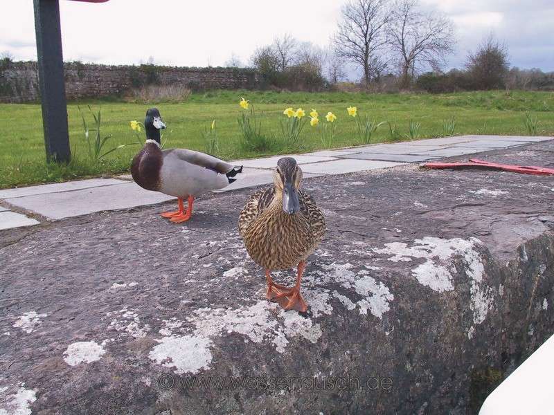
Before Jamestown, the navigation turns into the Jamestown Canal. We moor at the quay directly at the entrance of the canal. Gerda, a mighty cheeky duck is hard to keep off from storming our boat. Here in the Drumsna area, before reaching the canal, and visible from the boat, on the southern shore, are remains of a prehistoric massive earthen rampart Doonarah; Dun a'Ratha; fortress on a defence wall; today called "Doon of Drumsna". It was built to protect the royal Celtic rulers of Connacht (Connaught; Coonacht) in Rathcroghan (Cruachan) against invaders from the north. Here in the area around Drumsna were the only points in the Shannon, north of Athlone, which could be forded. This also explains why later the construction of the Jamestown Canal for navigation was necessary. East of Doon of Drumsna and the fords in the Shannon was a swampy bog. It was almost impassable, with only two passes over two ridges of glacial deposits. Both of these ways led to gates in the main wall, north of the Jamestown Canal. It is 30 m wide and 6 metres high. Walking from the mooring in the Jamestown Canal to Jamestown itself, the way leads on the lower road on a part of the Doon. On both sides of the main walls are parallel further ramparts. There are further walls in some places on the banks of the Shannon, probably to prevent a landing with boats.
It is estimated that about 10,000 people were employed for two years with the construction of the Doon, that 50-60 000 trees were used and 150 000 cubic metres earth moved. What a task in this period, as excavators were still unknown! The entire fortification is dated to the Iron Age, 2000 BC or earlier, at the time of Queen Maebh of Connacht.
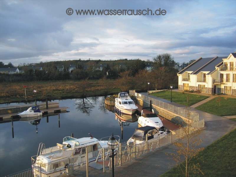
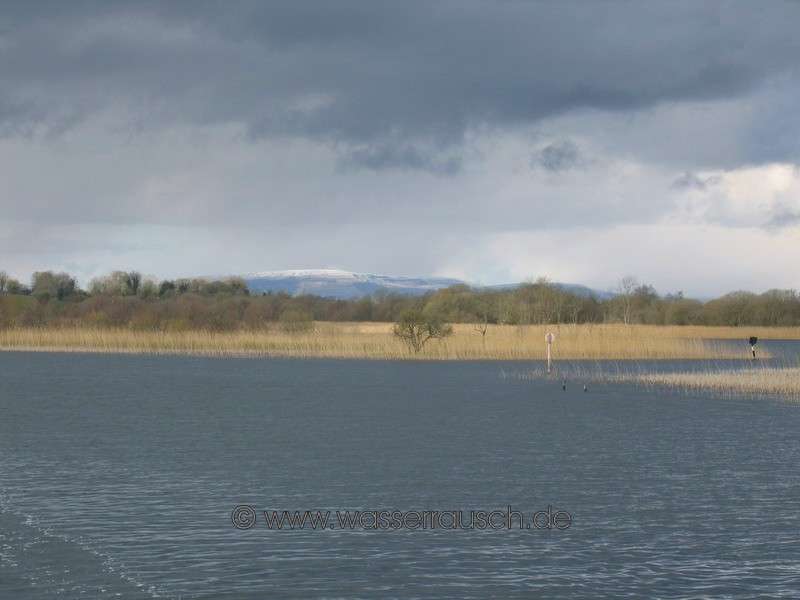
Turning on Lough Boderg towards the west you go into the Carnadoe Waters. The view back to the north shows us that Slieve Anierin has snow covering it today. After winding through the alluvial deposits at the mouth of the Carnadoe water, we reach a quay situated before a bridge, Carnadoe Quay. The quay is almost fully occupied with abandoned boats; they are seasonally "parked" there. But we still find a free place and stay. (Map 5 ). |
Mainpage Wasserrausch Contact Imprint
Copyright Tina und Willi Klug 2008