 |
The boat trip in April 2008 |
|
Log book Ireland April 2008
|
|
back to the
main page |
|
|
|
|

|
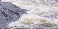
Monday 07.04.2008 Tully Inishmore - Crom Castle - Ballyconnell Length of boat trip: 5.7 hours Motto of the day: Boating with ice and kingfishers
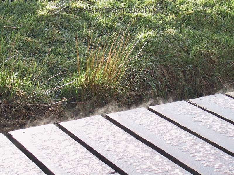
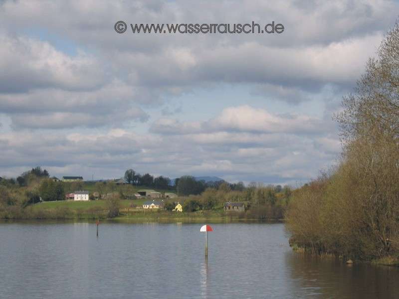
The night was very cold but, although I havent frozen, the water outside the windows has and the jetty is covered with ice! However, the warming sun of the morning quickly melts the ice and snow. The jetty steams in the sun, although up on Belmore Mountain the snow remains. We continue on to the south. Choosing the Tully Inishmore, western river section, you arrive with a view into the lowlands of Arney, Upper Lough Erne. We go on the eastern route to Carrybridge. There are - unlike last year - many boats still in their winter quarters on land. So we have the river and then Upper Lough Erne to ourselves and we enjoy it. After many bends the "Upper" opens with lots of islands. We choose the western route on the lake itself.
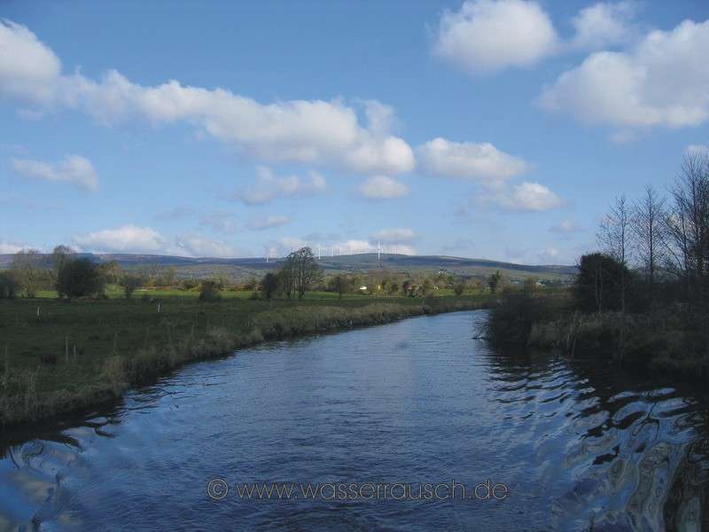
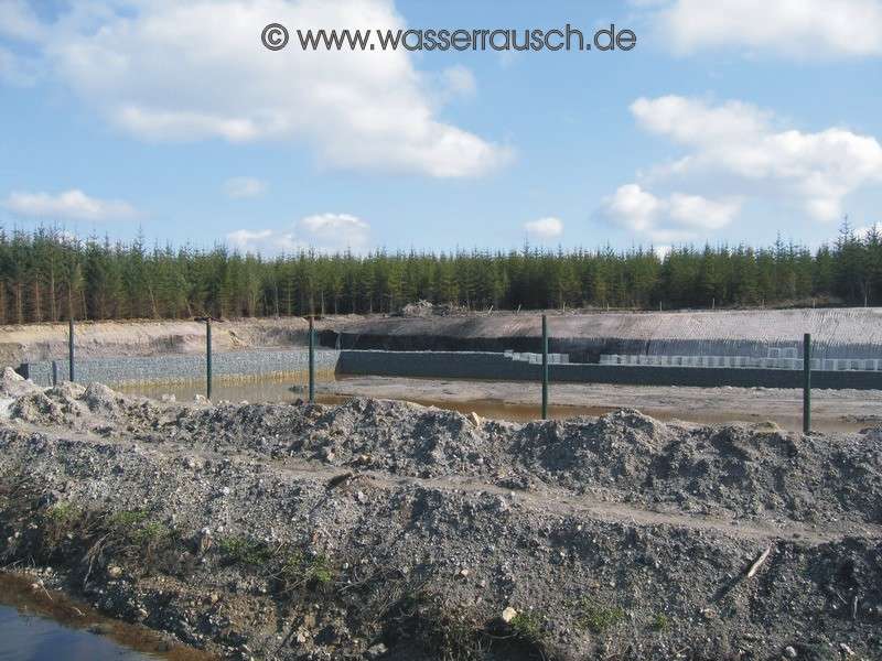
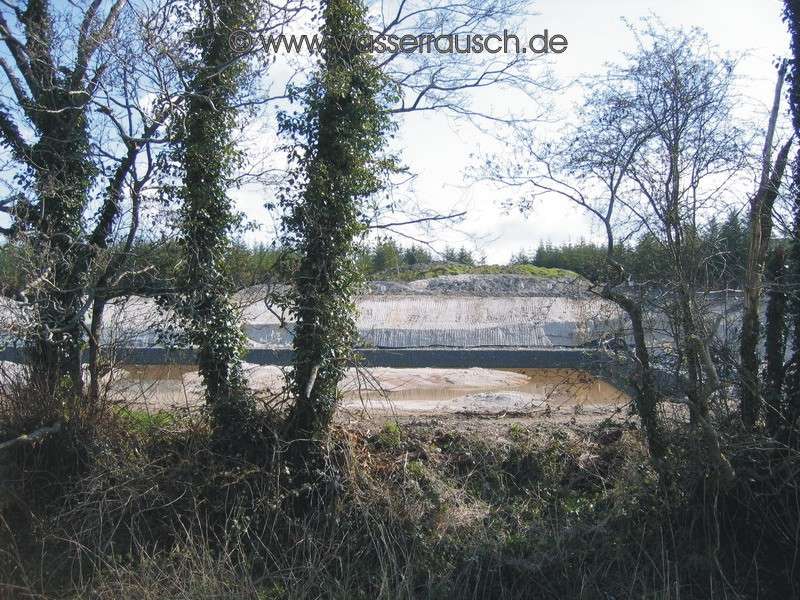
Again, the over 600 m high Cuilcagh is the most widely visible highest peak and today it is covered in snow. On the southern shore of the lake lies, not very high, but in contrast to the surrounding countryside, Knockninny Hill; Cnoc Ninnidh; Ninnidh's hill. St. Ninnidh was a grandson of King High Laoire living on Lower Erne at Inishmacsaint (lowlands of the common sorrel) from where he preached +- 523 AD. Above this is Slieve Russell; Slieve Rushen; (The picture shows it in 2007 taken from Crom Castle), with its 404 m, a sand and limestone hill with a flattened ridge and a number of wind turbines (Map 3). On top of it runs the border between Fermanagh and Cavan. Its flanks, with narrow valleys, protrude from the hilly, sparsely populated drumlin landscape and we will later meet the flanks again. Its western and southern slopes are planted with conifers. On its northern side is a transmission mast on the 287 m high Molly Mountain , it can also be seen from Tully Inishmore. But above all are the northwest Cuilcagh Mountain flanks, with distinctive limestone rock. On the eastern side of the Slieve Rushen, between Derrylin and Ballyconnell, there were thick moraines pushed up against the mountain and deposited there. On Gortmullen, therefore, there are not only limestone quarries but also sand and gravel pits. The drumlins in the Upper Lough Erne area are usually less steep than in the neighbouring northern river section towards Enniskillen and as the ice had flowed here in a southerly direction, they are also running north-south. Numerous moraines are around Derrylin, the most striking is a 600 m wide moraine between Derrylin and the Upper Lough which marks a standstill in a southern extension of the last ice sheets. Here all the drumlins are overlaid with a thick moraine material, especially the islands in the Upper, giving them so much of their own character. In Crom Castle, 10.2 km north of Belturbet, we reach the end of the Upper Lough Erne. Crom Estate has a mixture of wetlands, grasslands and parks; here is one of the largest semi forested areas in Ireland. The preserved oak forests are especially worth seeing. The animal and plant world of Crom is varied and also provides a habitat for two rare butterfly species. At Crom Castles jetty, we stop for our lunch break and then go a short distance further up the Erne and after that, into the river Woodford, upstream to Ballyconnell. North of Foalis Cut begins the 60 km long "Ballinamore and Ballyconnell Canal", now under the name" Shannon-Erne Waterway "(SEW). The term canal is also somewhat misleading, since it is a diverse waterway, with only 8 km of real channel character, 13 km running through lakes and the remaining 39 km of navigable rivers, largely retaining their natural character. From Lough Erne to Lough Scur we move also in principle on a river navigation: that means the water level is constantly changing, depending on the rainfall and it can also have a current sometimes. However, this time the water level is normal and we drive without special navigation requirements. The SEW leads through an extensive, hilly, drumlin landscape, mostly rural with Ballyconnell and Ballinamore as the significant places. It begins in the east with the river Woodford, the former "River Grainne". Coming upstream from the Erne, the Woodford leads firstly through flat meadows and small lakes, a landscape subject to floods then its winding increases through hilly pastureland. Numerous kingfishers accompany our journey again this year. Approx. 2 km before Ballyconnell on the southern bank is a piece of natural floodplain forest, typical of the original vegetation. It follows hilly grazing land, and we reach Ballyconnell with its expanding production facilities on the northern shore. Up here, we have the first two of the 16 locks in SEW. The first lock is located in Fermanagh, the second and third in Cavan and the remaining 13 in Leitrim.
Ballyconnell; Béal Átha Conaill; Entrance to the Ford of Conall; was formerly called Áth na Mianna, which means ford of the miners. Today I would call it the ford of construction site equipment and building material trucks. Also more and more apartment blocks are being built in the Callows, some with the charm of parking blocks and bunkers. The area around Ballyconnell, at the southern edges of the Slieve Rushen, was settled in early times, as a megalithic stone grave with two chambers in the area, dating to 3000 BC. shows. Another stone grave of the Bronze Age (in this case, wedge-shaped) in the area of Aughrim on Slieve Rushen was removed and rebuilt in the grounds of the Slieve Russell Hotel. In this respect, the Irish are not exactly concerned about their large numbers of old stone settlement remains. Except for two heavy showers, one of them hail, it was a sunny day. We are the only occupied boat in Ballyconnell and so we are the only ones to see a duck with more than 10 chicks on their first trip.
Tuesday 08.04.2008 Ballyconnell - Haughton Shore - Ballinamore - Kiltybardan Length of boat trip: 7 hours Motto of the day: Coffee on the flybridge in shirts, snow on the top of the mountains and more kingfishers
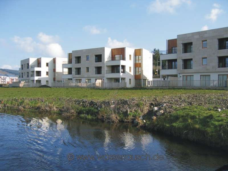
From Ballyconnell we continue westward on the Woodford, which is now less winding. Our view behind is of the rather gently curving foothills of Slieve Rushen. Especially to the north of this section of the river, there are many evidences of Bronze Age settlements but they cannot be seen from our boat. But further on, you can see in the middle of nowhere, in a tree plantation, a construction site for a new marina, located on this shallow river with its mostly narrow and small lakes. It is a fairly large marina next to a residential complex with tasteful, wooden houses.
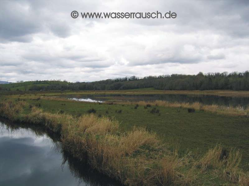
After the third lock, we reach an area with consecutive lakes, Coologue, Derrycassan, Ballymagauran, Garadice (Guth Ard Deas; Southern Guth Ard) whose real name is Lough Finvoya; Finnmhaighe; the lake of the fair plain. A Crannog in Ballymagauran and four in Lough Garadice also indicate early settlements. Lough Derrycassan is also the source of the river Woodford, which we leave at this point. .
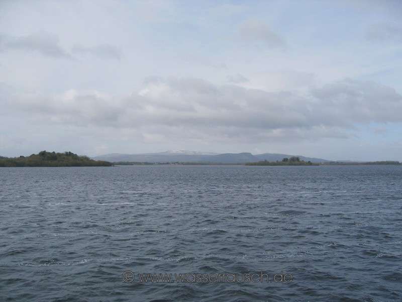
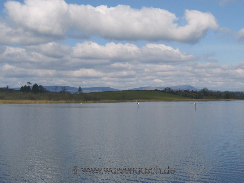
The southern end of Ballymagauran Lough is a good example of the growth of flooding areas. The navigation runs through reeds, which grow in up to 1.5 m deep water. Then follows a swamp with tufts of reed grasses in an area, which dries in summer. Then, growing on "drier" but still moist areas, alders, willows and birches, followed by heather areas with mosses and erica. If you look at the Ballymagauran Lough from the water to the mountains in the north (Map 3 ), you can see the Cuilcagh Mountains (today still with a little snow on top) and the Benbrack summits. We make our first stop today in Haughton Shore and, here again, we are the only occupied boat. We are sitting in our shirts on the flybridge drinking coffee. Even from here, the Cuilcagh can be seen, where a little stubborn snow still remains. From the Cuilcagh base the ice had flowed to the southeast and formed the drumlins there.
We continue on the calm Lough Garadice and through the Ballinamore lowlands along the southern flanks of the mountains Brenback (499 m) and later further west along Bencroy (513 m) and Slieve Anierin (585 m). Lough Garadice also has a beautiful view of most of these mountains.
A typical example of silted up water areas, covered with reed, are the wetlands on the western shore of Lough Garadice, where the Yellow River (in which we now move) reaches the lake, reduces its flow and its sediments deposited. From Lough Garadice, the navigation on the Yellow River makes a great curve to the south, then west and reaches Ballinmore in only a few kilometres. Up here, we pass two more locks and reach a third in Ballinamore; Béal an Átha Móir; Big Mouth of the Ford; originally lying on the main ford of the Yellow River, where we moor. After a while, we cruise on the more canalized navigation of the Yellow River, west of Ballinamore. To either side are a number of remains of old settlements, often in poor condition, such as the stone ruins on the golf course at Ballinamore, which we pass by. Here again, we encounter many kingfishers. After a few kilometers the Yellow River changes from its canal character and after a further lock we reach St. Johns Lough with Lough Kiltybardan nearby with a small Crannog. Here we are caught 5 minutes before reaching the jetty by the first really heavy shower of the day. The weather calms quickly and Lough Kiltybardan is presented in a beautiful evening light. It is the first jetty in the SEW, where we are not alone. On the Town Star next door is a German-speaking Irishman, who lives in Chile, with his Taiwanese girlfriend.
|
Mainpage Wasserrausch Contact Imprint
Copyright Tina und Willi Klug 2008