 |
The boat trip in April 2008 |
|
Log book Ireland April 2008
|
|
back to the
main page |
|
|
|
|

|
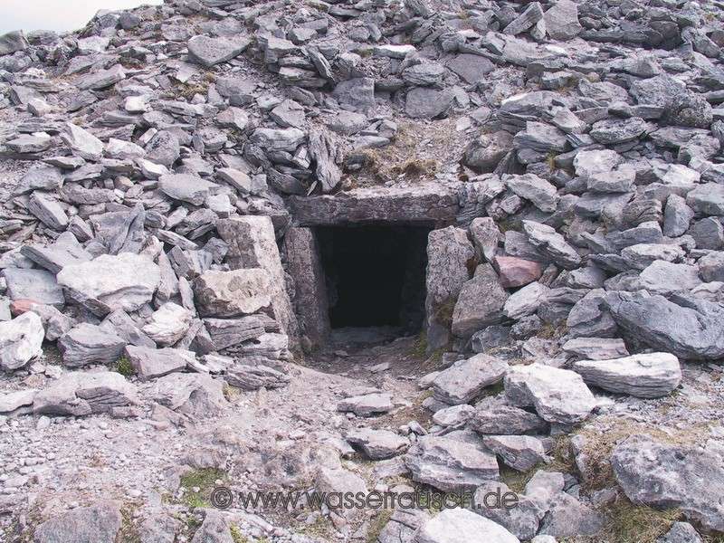
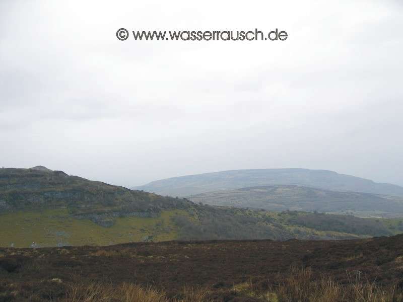
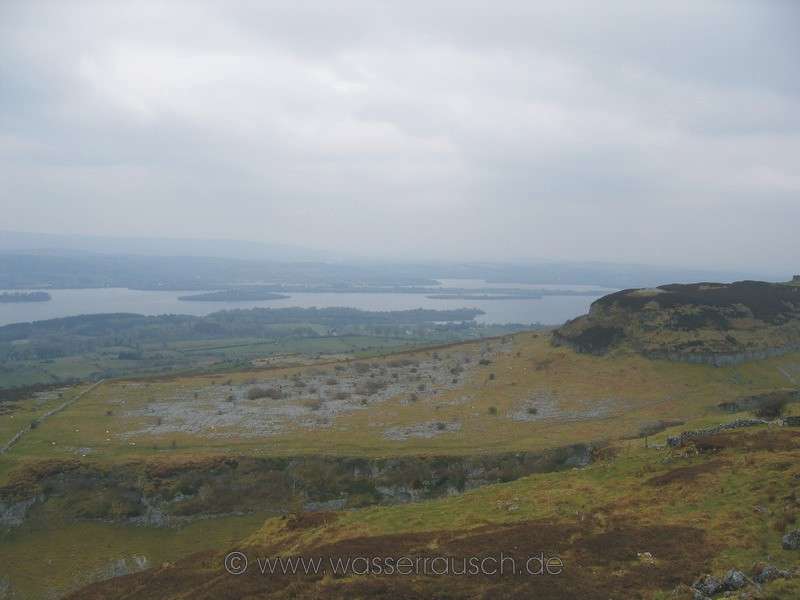
Monday 21.04.2008 Grange - Bricklieve Mountains - Grange Length of boat trip: 0 hours Motto of the day: Impressive old stones and tired feet It is dry, but hazy and the wind has finally ceased. It is also milder than yesterday. The pub owner kindly gives us a lift in her car to Strokestown. There we hire a car. We drive over to Boyle and though the Curlew Mountains to the Bricklieve Mountains (Map 4) . Both ridges rise steeply and their imposing harder limestone and sandstone formations differ from the glacial deposit-coated landscape. The Bricklieve Mountains especially provide, despite their small height of 312 m, a wide vista, in good visibility, over the northwestern part of Ireland. To the north, can be seen, in the direction of Sligo, Knocknarea with Queen Maeve's Cairn and the numerous Cairns of Carrowmore. Across Lough Arrow in a north-eastly direction lie the Arigna Mountains; Lough Allen is located behind them. Fifteen passage tombs are on the Bricklieves, partly in good condition, in the Carrowkeel Complex. There is no fence or guidance. The construction time can be dated to the period between 3500-2500 BC, but there are some indications that some parts were built before 5000 BC. I have visited Newgrange decades ago, as you could still start directly with guidance and were not channelled through the visitor centre. I was very impressed by the construction and the rock art. Stone Age art can not be expected in Carrowkeel, but the structures have a different dimension to the small Neolithic stone tombs along the waterways such as the mini-dolmen at Lough Scur at the SEW in Keshcarrigan. We are approaching Carrowkeel on a sidetrack along Kesh Corann (359 m). The valley at the entrance to the megalithic tombs on the Bricklieve Montains (321 m) is in itself breathtaking. The stone tombs are on a limestone plateau, which is cleft and subdivided with different levels and yet which is surpassed with an imposing view of Lough Arrow and to the north, Sligo Bay.
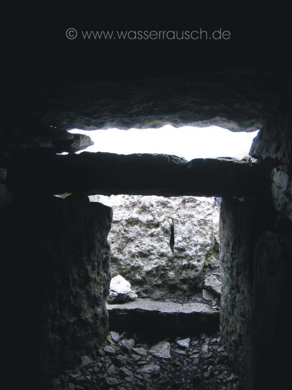
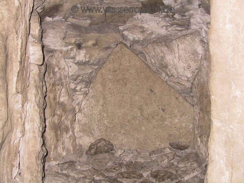
Cairn G is the first one that we reach. We are alone up here and take our time to let the atmosphere of this special location envelope us. Crawling around the entrance stone we then explore the interior. In the main chamber we can stand upright. Above the window stone, the light falls far into the main chamber.
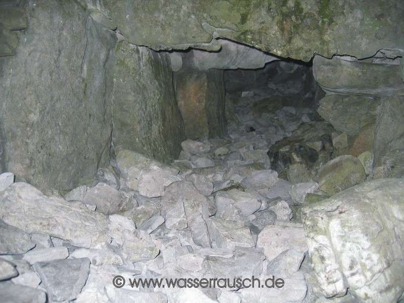
Next we explore the nearby Cairn H. The chamber is long, but altered by crazy archaeological trials with collapses caused by detonations and we can only take a look into it.
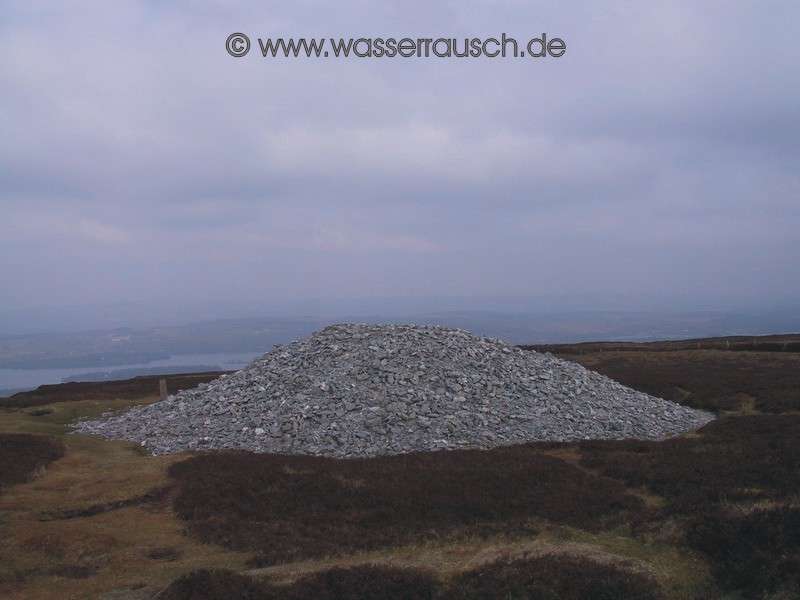
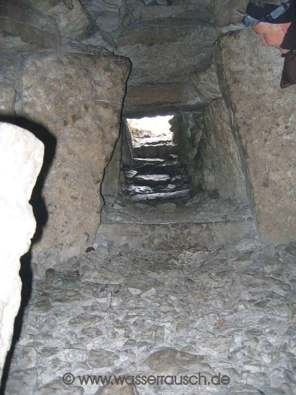
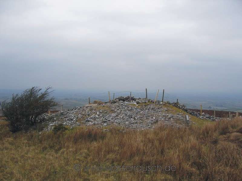
We go further on to the slightly higher Cairn K. It is impressive at this highest point on the northern end of the high plateau. From here you see Lough Key (Map 4). Cairn B, Kesh Corann with its cairn and Queen Maeve's cairn near Sligo are in a significant relationship with it. Access is made by crawling on all fours but the main chamber of the cross-shaped structure with three sub-chambers is almost twice head-high. The chambers, together with the entrance, also reflect the Southern Cross in the starry sky.
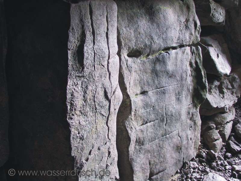
Some of the plate-formed stones of the sub-chambers have been moved away and, unfortunately, some people have recently spray-painted on and carved initials into the rock. They, apparently, have no regard for these old structures, which have survived to the present day. Would they also do this to the pyramids? But some of the structures in the rocks are of an older date. Whether they are natural banded stripes or engravings is in the eye and the imagination of the observer.
We would still like to climb the ridge with Cairn B in its completely exposed position but the way is too long and we have spent more than three hours with three cairns and their magic and views. Instead we go along a safe path made by sheep on the eastern edge of the plateau with a good view to Lough Arrow. Here we have a view to a lower rocky plateau on which there are the remains of a settlement with circular huts. Behind them, lies Lough Arrow in all its beauty.
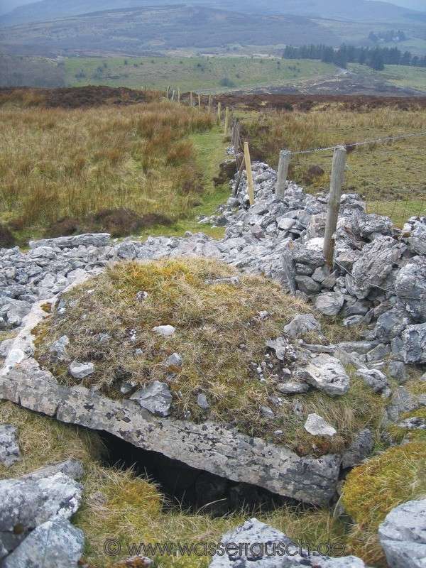
On our return we make a quick detour on a marshy path to the unfortunately, no longer fully intact, Cairnes C and D. Its unbelievable but a farmer has put a fence over the middle of the cairn and has used stones from this for fixing both sides of the fence!
After many hours and with tired feet, but very impressed by these buildings with their orientation according to the calendar referring to the moon and sun positions, we leave this magical place and drive back to Grange. The evening is quiet; we are once again the only occupied boat. |


Mainpage Wasserrausch Contact Imprint
Copyright Tina und Willi Klug 2008